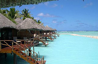
Cook Islands
The Cook Islands comprises 15 widely-dispersed islands in the South Pacific Ocean between French Polynesia and Fiji. The total land area of the country is 240 square kilometres, while the Cook Islands' exclusive economic zone covers a maritime area of nearly 2 million square kilometres. The Southern Group, comprising Rarotonga (the main island), Aitutaki, Atiu, Mangaia, Manuae, Mauke, Mitiaro, Palmerston and Takutea, are mostly of high volcanic formation (up to 652 metres on Rarotonga) with fertile soils and lush tropical vegetation. The exceptions are the small atolls of Manuae and Palmerston are small atolls, while Takutea, is a sandy key. The Southern Group possesses about 90 percent of the total land area of the Cook Islands. Rarotonga is the largest island (6,719 hectares) and Takutea, the smallest (122 hectares).
The Northern Group comprises Manihiki, Nassau, Penrhyn, Pukapuka, Rakahanga and Suwarrow. All except Nassau which is a sandy key, are low-lying coral atolls with sparse vegetation (coconut and pandanus trees etc) and large lagoons. Penrhyn is the largest island (984 hectares) and Suwarrow, the smallest (40 hectares).
The closest outer island to Rarotonga is Mangaia (204kms distant) while the farthest is Penrhyn (1,365kms away). The two most widely-separated islands of the country are Pukapuka, in the Northern Group, and Mangaia in the Southern Group (1,470kms apart).
Rarotonga is about 3,010 kms northeast of Auckland, 1,140 kms southwest of Tahiti, 2,300kms east of Fiji and 4,730 kms south of Hawaii.
Source : Cook Islands


0 Comments:
Post a Comment
<< Home